|
|
Glossary
Apennine Mountains
We usually
visualize the Apennines as running due north-south. We forget they also arc east to southwest. One point begins in the northwest of Italy, around
Genoa, and the other ends in the southwest, toward the Tyrrhenian Sea.
The Apennines extend 750 miles. At its narrowest point, it's 31
miles wide; at its broadest, the mountain range spans 60 miles in width.
The tree line goes up to 6200 feet. Above the tree line there are 21
peaks, with the tallest, Corno Grande, at 9550 ft. The Corno Grande lies 100 miles east of Rome, in the Abruzzi region.
A major river flows from the Apennines. It's the Tiber River,
rising near Arezzo, about 50 miles southeast of Florence.
In Etruscan times, the mountains barricaded the western from the eastern side of the peninsula.
Roads between the two were no more than primitive paths, the mountains
rugged, with ferocious mountain tribes waiting the brave or foolish.
Etruscan cities flourished on the broad plains of the west. East of the
mountains, only the town of Spina flourished. Spina lay where the Po River flowed into the Adriatic Sea, south of
present-day Venice. |
|
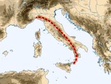
The Apennine
Mountains
The rock
composition of the Apennines is mostly limestone and dolomite. Over time, rain has dissolved
some of the rock, creating fissures known as "karst."
Karst terrain in
the central Apennines supports a large amount of ground water. The outflow
is estimated to be 58,000 gallons of
water per second.
|
|
|
|
|
|
|
|
|
|
|
|
|
Arno
River The Arno is a short river that flows through Florence.
Etruscan remnants can still be found in their main settlement, Fiesole,
outside Florence. The Arno is only 150 miles long.
Its headwater is 25 miles east of Florence in Mount Falterona in
the Apennines.
In Etruscan times, the mouth of the Arno went only to inland Pisa. From
Pisa to the sea was a large delta. Today, the Arno empties into the Ligurian
Sea, seven miles west of Pisa.
|
|
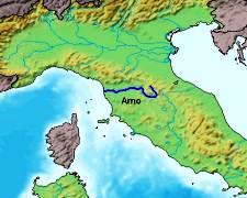
The Arno River
|
|
|
|
|
|
|
|
|
Calendar
and Dates
BCE, BC, CE, and AD:
BCE means "Before the Common Era."
It corresponds to the
traditional Western, Christian BC (i.e., "Before Christ").
CE means the
"Common Era". It corresponds to the Christian AD
(i.e., "In
the year of the Lord Jesus Christ"). There
is no Year 0.
The ancient world did not think of time or dates the way we do.
The Etruscans, Greeks, and Romans did not even have a word for "date."
The Etruscans had a calendar organized into twelve months with June as
the first month, but the calendar was a tool for priests to interpret
thunder. For example, if there was thunder on "September 5," the
crop barley would be bountiful but wheat would decrease.
Unlike the Romans, the Etruscan
calendar(s?) cited women and their activities. Today,
we do not have a single original
Etruscan calendar. They have all perished. |
|
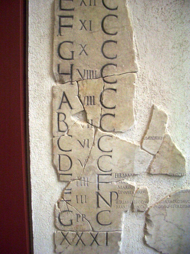 Roman Calendar,
Fragment. Fasti Antiates Maiores.
National Museum, Palazzo Massimo, Rome. Roman Calendar,
Fragment. Fasti Antiates Maiores.
National Museum, Palazzo Massimo, Rome.
|
|
|
|
|
|
|
|
|
Bronze
Bronze is an alloy made from copper and tin, greatly prized for sculpture, arms,
and military equipment. Copper with tin picks up a dull green patina
with age.
In the Renaissance, the word "bronzo"
appeared. This is not bronze. "Bronzo" meant an
alloy of copper and zinc, which we later call "brass." |
|
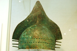
Etruscan Military Helmet.
Etruscan. 5th c BC. Bronze. Metropolitan Museum of Art, New York.
|
|
|
|
|
|
|
|
|
|
|
|
|
Bucchero Black
Pottery
Etruscan black pottery, heavily incised, is called bucchero.
Because of its shiny finish, bucchero appears to be metalware, a more
precious object.
The color
black was obtained by firing the clay without much air. Lacking oxygen, the air became heavy with carbon monoxide, which
converted the (red) iron oxide in the clay to black.
The Etruscans used many more animals, some real
and others imagined, in their
incised artwork than did the Greeks or, later, the Romans. |
|
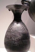
Black Vase with Animals.
Etruscan. 5th c BC.
Bucchero.
Getty Villa, Los Angeles.
|
|
|
|
|
|
|
|
|
Carthage
Carthage was located in present-day Libya,
North Africa, near Tunis.
Carthage rose to become a great Mediterranean power after the
Phoenicians migrated from their homeland in Syria to Carthage. (6th c
BC).
A formidable sea power, the
Carthaginians traded throughout the Mediterranean, establishing contact
with the Etruscans.
Carthage
held all the colored areas on this map except the Italian peninsula.
|
|
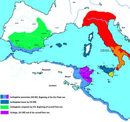
Map of the
Carthaginian Empire.
Courtesy:
Wikipedia |
|
|
|
|
|
|
|
|
|
|
|
|
City-States
There were about 30 Etruscan urban settlements cohesive enough to be a
city-state. They all shared a common culture and language, though
politically only a few united from time to time to fight an external
enemy.
Five—Cerveteri (Caere), Orvieto, Tarquinia, Veii,
and Vulci—were among the richest city-states in all the
Mediterranean. Vulci (Volsinii)surrendered over 2000
valuable bronze statues when sacked by
Rome
in the 3rd century BC. Even the Romans were astonished at the
extent of Vulci's wealth.
|
|
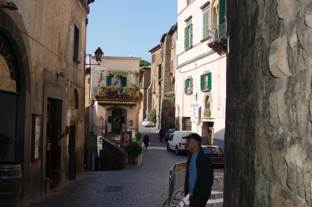 Orvieto
today Orvieto
today |
|
|
|
|
|
|
|
|
|
|
|
|
Cuniculus
A cuniculus was an ingenious type of drainage trench engineered by the Etruscans.
A reliable water supply was a big problem all over
the arid Mediterranean--too much water at times, and not enough in other
months. The Etruscans trapped water from springs in the Apennine
Mountains.
More water meant more crops, which allowed the population to
grow.
|
|
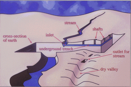
Etruscan
Cuniculus (modern sketch) |
|
|
|
|
|
|
|
|
Etruria
Etruria is the modern
term for the geographical territory(ies) inhabited by Etruscan people. |
|
|
|
|
|
|
|
|
|
|
|
Goldsmithing
The Etruscans were the premier goldsmiths of the ancient world. The
beauty of their works--its delicacy and intricacy-- stems from a technique of
"granulation" still not fully understood by modern science.
Granulation is the bonding of very small spheres (granules) of metal to
another metal surface. How could the Etruscans achieve granulation
without the invention of a solder? And with such incredibly small
granules (.14 mm)?
Archeologists and
chemists speculate they took an organic
glue, perhaps fish paste or cowhide glue, and mixed it with a copper mineral like
malachite. Under heat, a bond is formed. For a more
technical discussion:
Etruscan gold making techniques
|
|
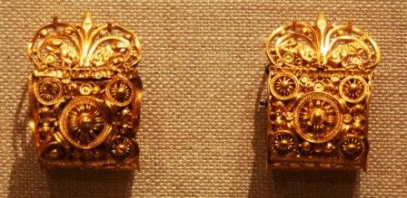 Etruscan jewelry. Gold granulated earrings.
Etruscan. 5th c BC.
Metropolitan Museum, New York. Etruscan jewelry. Gold granulated earrings.
Etruscan. 5th c BC.
Metropolitan Museum, New York. |
|
|
|
|
|
|
|
|
Greeks
During the Etruscan period, the Greeks were prevalent in colonies in
southern Italy and Sicily, especially Syracuse.
The Etruscans greatly admired the Greeks and collected things Greek.
Most ancient Greek vases extant today are from Etruscan
tombs in Italy, not from Greece. The extensive
collection of Greek vases at the Metropolitan Museum in New York
comes from Etruscan tombs.
The colonial Greeks handed the Etruscans a pivotal defeat at sea at
Battle of Cumae around 500 BC. |
|
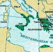
Map of Greek colonies in Italy,
c 500 BC.
Colonies are shown in green.
|
|
|
|
|
|
|
|
|
Phalanx
A phalanx was the
formation
of infantry devised by the Greeks. The Etruscans adapted it from
them. The
infantry, called hoplites, were armed with shields and spears. The first
rank of hoplites lined up shield-to-shield, sometimes with shields
overlapping. The next ranks projected their spears out over the
first rank of shields, thus presenting to the enemy both a wall of
shields and a large number of spear points.
This type of formation
required a great deal of discipline and training and generally worked
best on level ground. How the hoplites actually fought is still debated. |
|
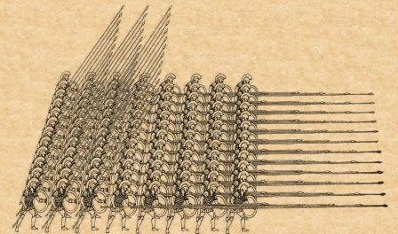
Greek Hoplite formation.
(modern sketch) |
|
|
|
|
|
|
|
|
|
|
|
|
Terracotta
Terracotta is
an unglazed ceramic made of clay. In the ancient world, once formed, the clay was then dried
or baked.
Terracotta objects were much less expensive to make than bronze.
This urn from Chiusi held the ashes of an Etruscan warrior. Long after burial became
widespread, the people of Etruscan Chiusi continued to
cremate their dead.
Their cremation urns often had articulated arms,
jewelry, wigs, even clothing. The lid presented a
stylized portrait of the deceased. |
|
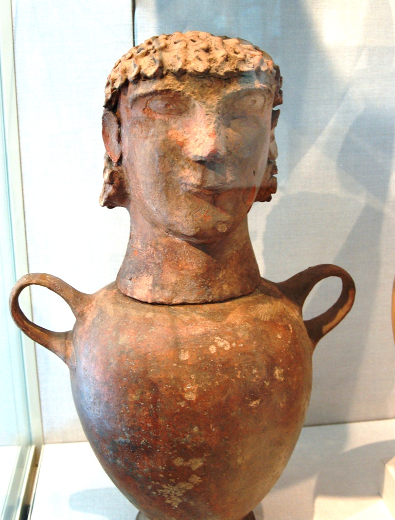
Etruscan cremation urn.
Etruscan, (from Chiusi). Terracotta. 6th c BC.
Metropolitan
Museum, New York. |
|
|
|
|
|
|
|
|
Tiber River
The Tiber is the river that flows through Rome.
The Tiber's headwaters are about 50 miles
southeast of Florence in the Apennines. It flows into the Tyrrhenian Sea.
The Tiber is 250 miles long. In ancient times, the Tiber was a broad, flat river, navigable for 60 miles inland.
As it flowed toward the sea, the Tiber drained
into a large flat area around Rome, periodically causing floods and
producing a marshy swamp around and in Rome. Much of Rome could
become underwater, with the Roman Forum an
impassable marsh.
The Etruscans established territory on the right (west) bank of the
Tiber. The Romans were across the river, to the east, on the left bank.
(The right bank means the
right side of the river as it flows
downstream to the sea. Today's Vatican and the Trastevere district are on the right bank and
the Roman Forum is on the left bank.)
--------------------------------------------
Updated 22 July 2016. You may contact me, Nancy Padgett, at
NJPadgett@gmail.com |
|
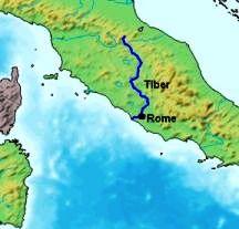
Map of the Tiber River in the Ancient World.
Courtesy: Wikipedia |
|
|